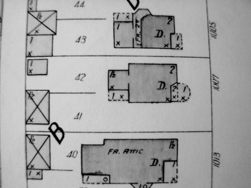
This is a copy of the Sanborn Insurance Map of 1905. It shows the footprint of the house. The larger structure at the lower-left of the house was a stable. It is unknown what the structure to the upper-left of the house was. Most likely it was a storage or feed shed. The numbers in the corner of each structure indicates how may stories it was.